
Top 10 widest states in the United States
The United States of America or the full name United States of America is a large country in the North American region. The United States is Federal, with the president as the head of the federal government. The United States is divided into 52 states. Among them, there are states that are less than 3,200 square kilometers, others that are more than 1,720,000 square kilometers. So, which are the widest states in the United States? In this article, let's find out.
6
State of Arizona
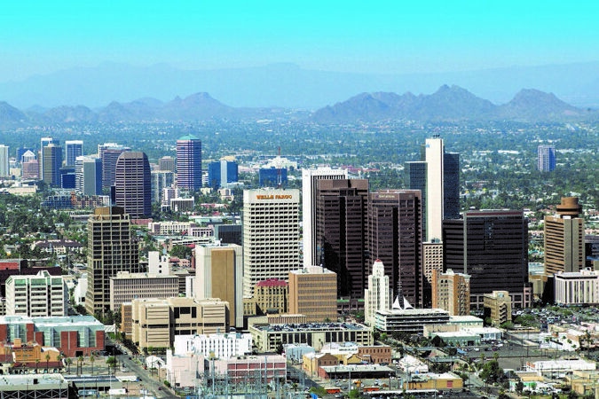
Area: 295,254 square kilometers or 113,998 square miles. Arizona is a state in the southwestern United States. It is also a Western U.S. state and belongs to the mountains. It is the sixth largest state in terms of area and the 14th most populous. The capital and largest city is Phoenix. Arizona is one of four Four Corners states. It is bordered by New Mexico, Utah, Nevada, California, and Mexico, and has one thing in common with Colorado. The border between Arizona and Mexico is 389 miles (626 km) long, with the Mexican st
7
State of Nevada
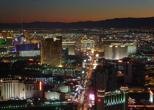

Tour Las Vegas Online.
Area: 286,351 square kilometers or 110,561 square miles Nevada (pronounced as Nevada) is a state located in the western United States, the 36th state to join the Union in 1864. Its capital is Nevada. Carson City and the largest city is Las Vegas. Nevada is nicknamed the Battle Born State ("State Born in War") to commemorate Nevada's admission to the Union that sided with the north during the American Civil War in the mid-19th century.. Nevada is a state by area. 7th largest in the United States, including the Great Basin to the north and the Mojave Desert to the south. In 2006, Nevada's population was estimated at 2.6 million, with 85% of the population living in the Las Vegas and Reno metropolitan areas. From a state where most of the land is arid, few people live, today Nevada has risen to become one of the richest states in the United States with the main economic sectors being mining, livestock, and casinos. and travel. In 2006, Nevada's gross national product was $117 billion. The median income of Nevadans is $46,108, ranking 11th in the nation.
8
State of Colorado
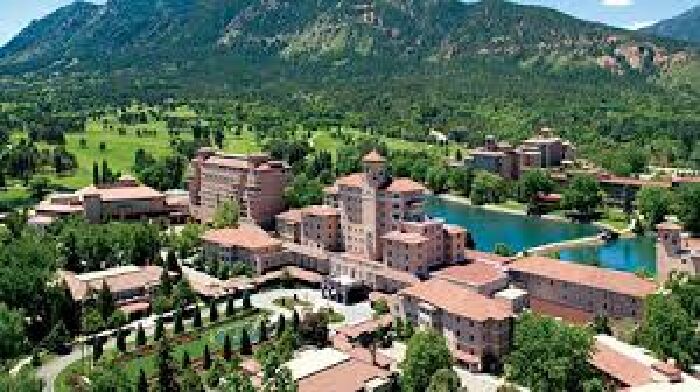

Discover Denver - the capital of Colorado
Area: 269,601 square kilometers or 104,094 square miles Colorado is a western state in the central United States. The state is famous for its mountainous terrain. To the east of the Front Range of the Rocky Mountains is the eastern Colorado Plain, part of the Great Plains in Colorado that ranges in elevation from 1,000 to 2,000 meters (3,500 to 7,000 feet). Kansas and Nebraska lie beside Colorado to the east. The plain is sparsely populated and most people live along the South Platte and Arkansas rivers and 70th Street. The state has very little rainfall, with an average annual rainfall of 380 millimeters (15 inches). The region has only a few irrigated lands, and most of the land is devoted to dryland agriculture or ranching. Winter wheat is the signature crop and most of the small towns in the region boast both water towers and threshing machines. From west to east, the state's land is a desert-like basin that becomes a plateau, then alpine mountains, then grasslands of the Great Plains. Mount Elbert is the highest peak of the Rocky Mountains in the continental United States. The famous Pike Peak is a little west of Colorado Springs. Its lone peak can be seen from near the Kansas border on sunny days.
9
State of Oregon

Khám phá Portland - bang Oregon.
Area: 254,805 square kilometers or 98,381 square miles. Oregon is a state in the Pacific Northwest region of the United States. The area was inhabited by many indigenous tribes before fur traders, explorers and settlers arrived. The Oregon Territory was created in 1848 after American settlement in the early 1840s. Oregon became the 33rd U.S. state on February 14, 1859. Oregon is located on the Pacific coast between Washington state to the north, California to the south, Nevada to the southeast and Idaho to the east. The Columbia and Snake Rivers form Oregon's northern and eastern boundaries, respectively. Salem is the state's third most populous city and also the capital. The most populous city in the state is Portland. Portland currently ranks 30th among the largest cities in the United States with a population of 575,930 (2008 est.) and a metropolitan area population of 2,175,133 (2007 est.), the 23rd largest metropolitan area in the United States.
10
State of Wyoming
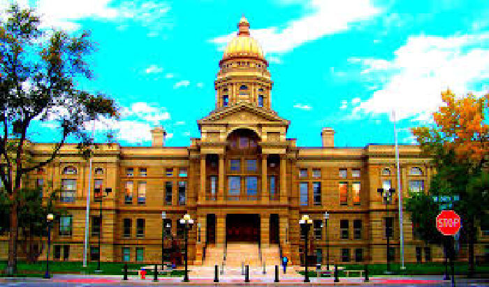
Area: 253,348 square kilometers or 97,818 square miles Wyoming is a mountainous state, located in the western United States. It is the 10th largest, least populous, and 2nd sparsely populated state in the country. Wyoming borders Montana to the north, South Dakota and Nebraska to the east, Colorado to the south, Utah to the southwest, and Idaho and Montana to the west. The state's population in 2018 was estimated at 577,737, or fewer than 31 U.S. cities, including neighboring Denver. Cheyenne is the capital and largest city, with a population of 63,624 (2017). Wyoming's economy is based on mining—primarily coal, oil, natural gas, tourism—and tourism. Agricultural products include cattle meat (beef), straw, sugar beets, wheat, barley, and wool. The climate is semi-desert and continental, drier and windier than the rest of the United States. Politically, Wyoming has been a conservative state since the 1950s, with the Republican candidate coming out on top in every presidential election with the exception of 1964
Suitable for you
17-11-2023 cookie
21-10-2023 cookie
06-10-2023 cookie
05-10-2023 cookie