In practice there are many factors that affect how the entire length of a river is calculated, for example determining where to originate, locate the estuary, as well as the size of the means of measuring the length from the source to the estuary. Hence the length of the lot of the river is just the approximate length. In particular, there are many debates about whether the Nile or the Amazon River is the world's longest river. The Nile is now considered to be the longest river in the world, but a few years ago Brazilian and Peruvian scholars have theorized that the new Amazon River is the longest river. Let's see the Top 10 longest rivers on the planet for an answer.
1 Nile River, Northeast Africa (6,650 km)
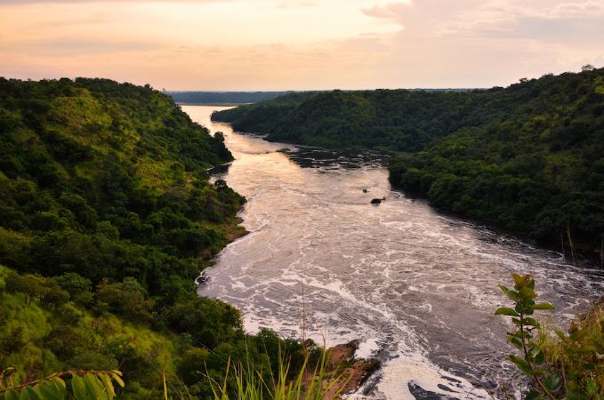
The Nile is the African River, the main river of the North African region, often regarded as the longest river in the world, with a length of 6,853 km and pouring water into the Mediterranean, but there are a number of other sources for research in the 2007 that this river is only the second longest after the Amazon River in South America. The Nile River is known as the "international" river because its basin covers 11 countries including Tanzania, Uganda, Rwanda, Burundi, the Democratic Republic of the Congo, Kenya, Ethiopia, Eritrea, South Sudan, Sudan and Egypt.
It is the most influential river in Africa, associated with the formation, development and destruction of many ancient kingdoms, contributing to the creation of the Nile civilization.
2 Amazon River, South America (6,400 km)
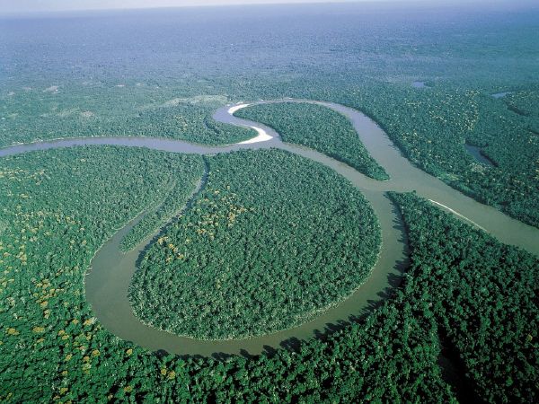
The world's second-longest Amazon river with the world's largest average water flow, the larger the water flow of the seven largest rivers in the world stands right after it in the rankings.
The Amazon flows split into countries: Brazil, Peru, Bolivia, Colombia, Ecuador, Venezuela, Guyana and the Atlantic Ocean. The Amazon River occupies about 20% of the total freshwater flow pouring out the oceans.
3 Yangtze River, China (6,300 km)
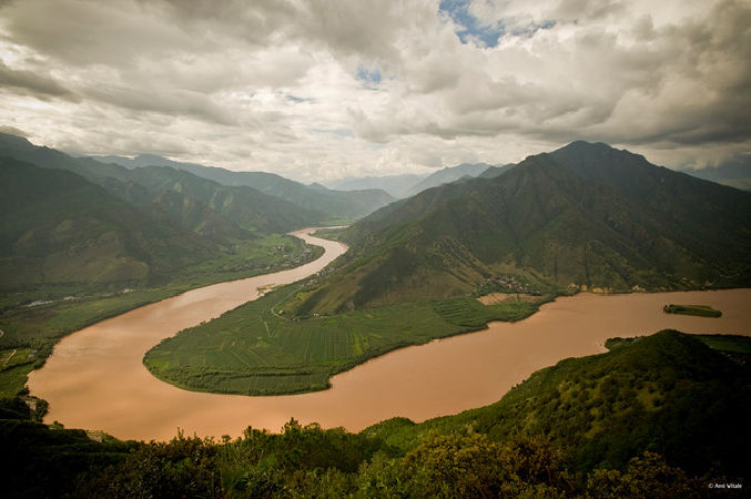
Yangtze River (also known as Yangtze River) is the longest river in Asia and the third largest in the world.
It is about 6,385 km long, originating from the western part of China (Qinghai) and flows east into the East China Sea. It is usually regarded as a division between the northern and southern China states.
Yangtze is the most important river in the history, culture, and economy of China. The fertile Yangtze Delta produces 20% of China's GDP. Truong Giang flows through many diverse ecosystems and itself is a habitat for many endemic species and endangered species such as Chinese crocodile and Yangtze sturgeon. Over the thousands of years, people have used the river to get water, irrigated, sweetened, transported, industrial, boundaries and war. Tam Hiep Dam on Jiang is the largest hydropower company in the world.
4 Mississippi – Missouri – Jefferson, North America (6,275 km)
The Mississippi River is a river in North America. The river is 3,733 kilometres (2,320 mi) from Lake Itasca to the Gulf of Mexico. Another river in North America is the Missouri River, with a length of 3,767 kilometres (2,341 mi) from the junction of the Jefferson River, the Madison River and the Gallatin River to the Mississippi River. The subsequent rivers Jefferson, Missouri and Mississippi formed the largest river system in North America.
5 Yenisei River, Asia (5,539 km)
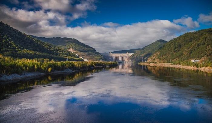
Yenisei is one of the largest river systems that pour out into the Arctic Ocean. Originating from Mongolia, flowing through Russia, where 97% of the river's water flow flows through the Russian territory and only 3% of the remaining traffic flows through Mongolia, and its currents pour into the Kara sea. This is also the largest river system flowing into the Arctic Ocean.
6 Yellow River, China (5,464 km)
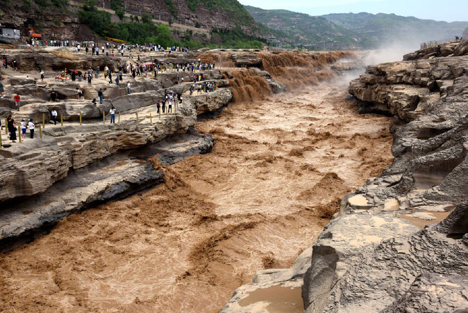
Hoang Ha is the second longest river in Asia after the Yangtze River (Yangtze), with a length of 5,464 km of Hoang Ha River, ranked sixth in the world in length.
The Yellow River flows through the nine provinces of the Chinese CHND, derived from the Bayan Har Mountains of the Kunlun Mountains on the Tibetan Plateau in the west of Qinghai province. Hoang Ha poured out Bohai Sea in the near Dong Dinh city in Shandong province.
7 Ob – Irtysh, Asia (5,410 km)
The Obi River is a major river in western Siberia, Russia, and the fourth-longest river in the country.
The Obi River is formed in Altai Krai, 13 kilometres (8 mi) southwest of Biysk, due to the tributaries of the Biya and Katun rivers. Both rivers originate in the Altai Mountains. The Biya River, 301 km (187 mi) long, flows from Lake Teletskoye, while the Katun River is 688 km (427 mi) long, flowing from a glacier on Byelukha mountain. The Obi River flows to the west and north until it reaches the latitude 55 ° north, where it bends northwards, and again northwards, and eventually turns north to the northeast to fill the Bay of Obi, a 966 km (600 mi) Bay of the Kara Sea, linking into the Arctic Ocean.
8 Paraná – Río de la Plata, South America (4,880 km)

Paraná – Río de la Plata is a major South American river. The river flows through 5 countries: Brazil, Argentina, Paraguay, Bolivia and Uruguay. Paraná – Río de la Plata is the second longest river in South America after the Amazon River. It flows along the border between Uruguay and Argentina before emptying into the Atlantic Ocean.
9 Congo – Chambeshi, Africa (4.700 km)
The Congo River is a river in western Central Africa, which is named after the Democratic Republic of the Congo (formerly Zaire) and the Republic of the Congo. The entire length of the Congo River is located inside the Democratic Republic of the Congo or forms part of its border. With a length of 4,700 km, the Congo River is the second longest river in Africa (after the Nile) and one of the longest rivers in the world. The Congo River is also one of the world's largest water flow and basin rivers. The Congo River basin covers an area of 3,680,000 km² and the large water season flows approximately 41,800 m³ per second. Located in the rainy ring area of Africa, the Congo River carries many second countries, only after the Amazon River. As a river of shipping can flow into Africa, the Congo River is a major transport artery and has a prominent role in the history of the region.
10 Amur – Argun, Asia (4.444 km)
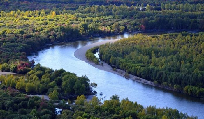
The Amur – Argun is a natural border between the Russian Far East and north-eastern China. The Amur River is made up of a mixture of two Argun and Shilka lines, winding the dragon bending, so that it also has the name the Black Dragon River. The river flows into the Pacific Tartar Bay.
