The United States of America or the full name United States of America is a large country in the North American region. The United States is Federal, with the president as the head of the federal government. The United States is divided into 52 states. Among them, there are states that are less than 3,200 square kilometers, others that are more than 1,720,000 square kilometers. So, which are the widest states in the United States? In this article, let's find out.
1 State of Alaska
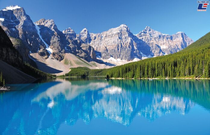
Image of the state of Alaska. Source: Du học UE
Area: 1,717,855 square kilometers or 663,267 square miles. Alaska is a state of the United States of America, located at the northwest end of the North American continent. Alaska borders Canada to the east, the Arctic Ocean to the north, and the Pacific Ocean to the west and south, facing Russia across the Bering Strait. Alaska is the largest, least populous, and least populous state in the United States (due to most of its location in the far north). Approximately half of Alaska's 731,449[3] residents live in the Anchorage metropolitan area. Dominating the economy of Alaska are the oil, natural gas, and fishing industries, which are also resources in which Alaska has abundant reserves. Tourism is also an important component of the state's economy.
2 State of Texas
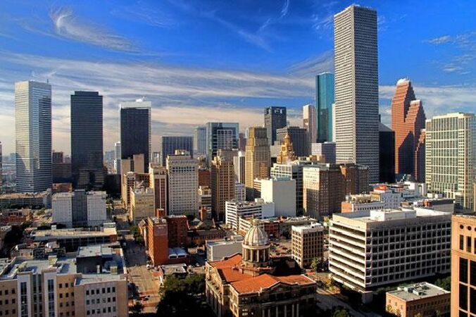
Image of the city of Houston, Texas. Source Mạng du học Mỹ.
Visit Houston.
Area: 696,621 square kilometers or 268,581 square miles Texas is the second most populous state and the second largest by area of the 50 states of the United States of America, and the largest of the 48 contiguous states. of the United States. Geographically, Texas is located in the south-central region of the country, bordering the Mexican states of Chihuahua, Coahuila, Nuevo León, and Tamaulipas; Within the United States, Texas is bordered by New Mexico to the west, Oklahoma to the north, Arkansas to the northeast, and Louisiana to the east. Houston is the largest city in Texas and the fourth largest city in the United States, while San Antonio is the second largest city in the state and the seventh largest in the United States. Dallas–Fort Worth and Greater Houston are the fourth and fifth largest metropolitan areas in the United States, respectively. Other major cities in Texas are El Paso and the capital, Austin. One industry that prospered after the Texas Civil War was cows. As the center of this industry for a long time, people associate Texas with the image of cowboys. The state's economic situation changed at the turn of the 20th century, and the discovery of oil inaugurated a period of economic boom in Texas. Along with strong investments in universities, Texas developed a diversified economy and high-tech industry in the mid-twentieth century. According to 2010 data, Texas ranks first among the states with Fortune 500 companies, tied with California. With a growing economy, Texas has become the leading state in the United States in many economic sectors, such as agriculture, petrochemicals, energy, computers and electronics, aerospace, and biomedical sciences . Texas has also led the nation in exports since 2002 and has the second-highest gross state product.
3 State of California

San Francisco, California. Source: Du học Mỹ
See the city of Los Angeles.
Area: 423,970 square kilometers or 163,696 square miles of California (pronounced "California" or "California", if quick: "California" "), also known briefly as Ca Li by the Vietnamese, is a western coastal state of the United States. With a population of 38 million people. California is adjacent to the Pacific Ocean, Oregon, Nevada, Arizona and the Mexican state of Baja California. The state has many beautiful natural sights, including the spacious Central Valley, high mountains, hot deserts, and hundreds of miles of beautiful coastline. With an area of 411,000 square kilometers (160,000 mi2), it is the third largest state in the United States and larger than both Germany and Vietnam. Most of the state's major cities are located on or near the Pacific coast, notably Los Angeles, San Francisco, San Jose, Long Beach, Oakland, Santa Ana/Orange County, and San Diego. However, the state capital, Sacramento, is a large city located in the Central Valley. The geographic center of the state belongs to North Fork, California. California's geography is rich, complex, and diverse. Midstate lies the Central Valley, a large, fertile valley bordered by coastal mountains to the west, the Sierra Nevada granite mountains to the east, the igneous Cascade Mountains to the north, and The Tehachapi Mountains in the south. Rivers, dams, and canals flow from the mountains to irrigate the Central Valley. Most of the state's water is provided by the State Water Project. California has 478 cities, most of which are located in large metropolitan areas. 68% of California's population lives in the two largest metropolitan areas, the Greater Los Angeles area and the San Francisco Bay Area.
4 State of Montana
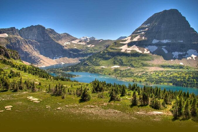
Rocky Mountains of Motana. Source EFLY.vn
Area: 380,838 square kilometers or 147,042 square miles. Montana is a state located in the northwestern United States, the 41st state to join the Union on November 8, 1889. Montana's capital is Helena, while its largest cities are Billings and Great Falls. The state of Montana is famous for its vast and majestic hilly regions north of the Rocky Mountains. As the 4th largest state in area but 44th in population, Montana is one of the most sparsely populated states in the United States. The economy of this state is mainly based on agriculture, logging, minerals and tourism. The state's name Montana is derived from montaña (Spanish for "mountain"). Montana is also known as The Treasure State because of its vast natural resources or Big Sky Country because of its magnificent pristine mountain scenery. Montana has many famous beautiful national parks.
5 State of New Mexico
Image of a corner of Mew State Mexico. Source: American Travel
Area: 314,915 square kilometers or 121,589 square miles. New Mexico (transliteration: New Mexico, Spanish: Nuevo México [ˈnweβo ˈmexiko]; Navajo: Yootó Hahoodzo [jò:txó hahò:tsò]) or New Mexico is a state located in the region. Southwest United States. New Mexico became the 47th state on January 6, 1912. It is often referred to as a Mountain state. New Mexico has the fifth largest area, the 36th largest population, and the sixth lowest population density of the 50 US states. Inhabited for thousands of years before the arrival of Europeans, New Mexico became part of the Spanish Empire's New Spain colony in 1598. It was later part of Mexico. independence before becoming a U.S. territory and eventually a U.S. state as a result of the Mexican-American War. Of the states, New Mexico has the highest percentage of Hispanics, including descendants of Spanish colonists who have lived here for more than 400 years. It also has the second-highest percentage of indigenous peoples after Alaska, and the fourth-highest total native population after California, Oklahoma, and Arizona. The majority of the indigenous people belong to the Navajo, Pueblo, and Apache peoples. State culture is shaped by these Hispano and Indigenous influences and is reflected in the state flag. The red and gold colors are taken from the Spanish crown, with the ancient Zia sun symbol.
6 State of Arizona
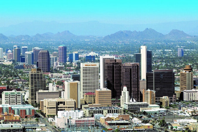
Panoramic view of the city of Phoenix, Arizona. Source: Ustime
Area: 295,254 square kilometers or 113,998 square miles. Arizona is a state in the southwestern United States. It is also a Western U.S. state and belongs to the mountains. It is the sixth largest state in terms of area and the 14th most populous. The capital and largest city is Phoenix. Arizona is one of four Four Corners states. It is bordered by New Mexico, Utah, Nevada, California, and Mexico, and has one thing in common with Colorado. The border between Arizona and Mexico is 389 miles (626 km) long, with the Mexican st
7 State of Nevada
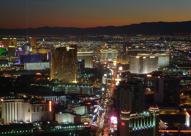
Las Vegas, Nevada. Source:
Tour Las Vegas Online.
Area: 286,351 square kilometers or 110,561 square miles Nevada (pronounced as Nevada) is a state located in the western United States, the 36th state to join the Union in 1864. Its capital is Nevada. Carson City and the largest city is Las Vegas. Nevada is nicknamed the Battle Born State ("State Born in War") to commemorate Nevada's admission to the Union that sided with the north during the American Civil War in the mid-19th century.. Nevada is a state by area. 7th largest in the United States, including the Great Basin to the north and the Mojave Desert to the south. In 2006, Nevada's population was estimated at 2.6 million, with 85% of the population living in the Las Vegas and Reno metropolitan areas. From a state where most of the land is arid, few people live, today Nevada has risen to become one of the richest states in the United States with the main economic sectors being mining, livestock, and casinos. and travel. In 2006, Nevada's gross national product was $117 billion. The median income of Nevadans is $46,108, ranking 11th in the nation.
8 State of Colorado
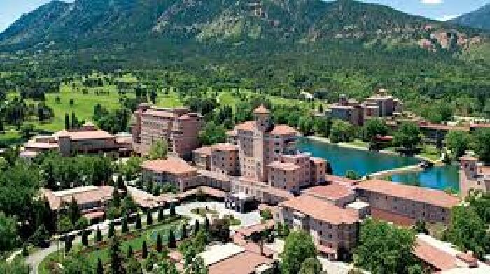
From above Denver, Colorado. Source: Dan Tri
Discover Denver - the capital of Colorado
Area: 269,601 square kilometers or 104,094 square miles Colorado is a western state in the central United States. The state is famous for its mountainous terrain. To the east of the Front Range of the Rocky Mountains is the eastern Colorado Plain, part of the Great Plains in Colorado that ranges in elevation from 1,000 to 2,000 meters (3,500 to 7,000 feet). Kansas and Nebraska lie beside Colorado to the east. The plain is sparsely populated and most people live along the South Platte and Arkansas rivers and 70th Street. The state has very little rainfall, with an average annual rainfall of 380 millimeters (15 inches). The region has only a few irrigated lands, and most of the land is devoted to dryland agriculture or ranching. Winter wheat is the signature crop and most of the small towns in the region boast both water towers and threshing machines. From west to east, the state's land is a desert-like basin that becomes a plateau, then alpine mountains, then grasslands of the Great Plains. Mount Elbert is the highest peak of the Rocky Mountains in the continental United States. The famous Pike Peak is a little west of Colorado Springs. Its lone peak can be seen from near the Kansas border on sunny days.
9 State of Oregon
A corner of Oregon. Source: Dan Tri
Khám phá Portland - bang Oregon.
Area: 254,805 square kilometers or 98,381 square miles. Oregon is a state in the Pacific Northwest region of the United States. The area was inhabited by many indigenous tribes before fur traders, explorers and settlers arrived. The Oregon Territory was created in 1848 after American settlement in the early 1840s. Oregon became the 33rd U.S. state on February 14, 1859. Oregon is located on the Pacific coast between Washington state to the north, California to the south, Nevada to the southeast and Idaho to the east. The Columbia and Snake Rivers form Oregon's northern and eastern boundaries, respectively. Salem is the state's third most populous city and also the capital. The most populous city in the state is Portland. Portland currently ranks 30th among the largest cities in the United States with a population of 575,930 (2008 est.) and a metropolitan area population of 2,175,133 (2007 est.), the 23rd largest metropolitan area in the United States.
10 State of Wyoming
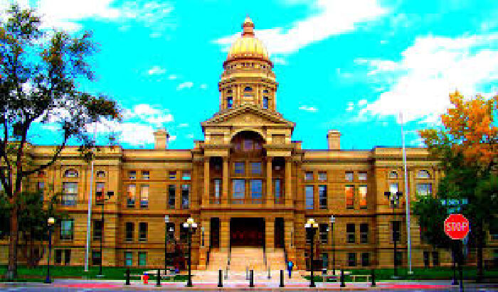
Wyoming City Hall. Source: Tiền ảo.
Area: 253,348 square kilometers or 97,818 square miles Wyoming is a mountainous state, located in the western United States. It is the 10th largest, least populous, and 2nd sparsely populated state in the country. Wyoming borders Montana to the north, South Dakota and Nebraska to the east, Colorado to the south, Utah to the southwest, and Idaho and Montana to the west. The state's population in 2018 was estimated at 577,737, or fewer than 31 U.S. cities, including neighboring Denver. Cheyenne is the capital and largest city, with a population of 63,624 (2017). Wyoming's economy is based on mining—primarily coal, oil, natural gas, tourism—and tourism. Agricultural products include cattle meat (beef), straw, sugar beets, wheat, barley, and wool. The climate is semi-desert and continental, drier and windier than the rest of the United States. Politically, Wyoming has been a conservative state since the 1950s, with the Republican candidate coming out on top in every presidential election with the exception of 1964
